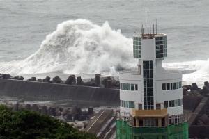
Typhoon Malakas caused widespread disruption across Taiwan as it gave a glancing blow to the island. But the worst of the weather remained offshore as the eye of the storm passed about 130km to the east of Taipei.
As Malakas passed, sustained winds at the centre of the storm were around 200 kilometres an hour, equivalent to a strong Category 3 storm on the Saffir-Simpson scale used to measure Atlantic hurricanes.
On the mainland, those winds were nearer to 100km/h, which was strong enough to cause widespread disruption across much of northern Taiwan.
Flights and train services were suspended and, according to the island’s Central News Agency, more than 2,700 people had to be evacuate their homes.
Businesses were ordered to close across the northeast throughout the weekend, as violent winds accompanied by torrential rains battered the island.
Taipei usually gets around 244mm of rain during September. It’s likely that the city could come close to reaching the total by the end of the weekend.
New Taipei City reported 50mm of rain in only three hours on Saturday. That was followed by further heavy rain through much of Sunday.
Mudflow alerts were issued by the Soil and Water Conservation Bureau and at least 6,600 households were left without power.
The storm is now moving northeast towards Japan. The east coast of China is braced for heavy rain at times, but fears are greater still across the East China Sea.
Tongyeong in South Korea recorded 153mm of rain on Sunday as the remnants of Typhoon Meranti crossed the country. It then went on to drop 104mm of rain on Hiroshima in the same 24-hour period.
Malakas is gathering forward momentum and will weaken as it heads towards Kyushu at some time on Tuesday.
By that time it will barely be a typhoon, but it is expected to bring further heavy rain to the already saturated ground across much of southern Japan, and a prolonged spell of flooding is expected.


